Canvas GIS Advanced (Mac) 9.0.4
GIS Mapping support plus illustration, image editing, & presentation features.
CANVAS 9 Advanced GIS Mapping Edition: Direct support for Geographic Information System data. You can take measurements in geographic coordinates, import any popular GIS file types into unlimited numbers of automatically aligned overlapping layers.
Software Specs
Publisher:............ ACD Systems
License:............... Shareware
Price:................... $999.95
Expire: ................ 15
File size:.............. 51.9 MB
Downloads:......... 727
Release date:...... 30 Apr 2004
Last update:........ 30 Aug 2011
Language:............ English
Publisher review for Canvas GIS Advanced (Mac) 9.0.4:
Review by: ACD Systems
The CANVAS 9 Advanced GIS Mapping Edition adds native support for Geographic Information System (GIS) data to Canvas. You can take measurements in geographic coordinates, import industry standard SHAPE and GeoTIFF files into unlimited numbers of automatically aligned overlapping layers and choose among the following options:
·2,104 Coordinate Reference Systems
·67 Operation Methods (like Mercator, Albers Conic Equal Area…)
·1,052 Map Projections
·302 Geodetic Datums
·21 Angular units
·45 Length units
The CANVAS 9 Advanced GIS Mapping Edition bridges the gap between dedicated GIS analysis software and generic "DTP" software. For many applications CANVAS 9 Advanced GIS Mapping Edition can now replace programs costing thousands. For the rest, CANVAS 9 GIS Mapping Edition is now the preferred "last mile" publishing companion to dedicated GIS analysis software.Files Supported include:
oMapInfo oARC/INFO oUSGS Digital Line Graphs oTIGER(Census) oMrSID (Win. only) oGML (Geography Markup Language) oSDTS (USGS Spatial Data Transfer Standard) oGIS Text oGarmin (GPS) oECW (Enhanced Compressed Wavelet Images oS57 (IHO International Hydrographic Organization)
Requirements:
Mac OS X, 128 MB RAM 100 MB HD, 16-bit graphics, 1024 x 768 res
Operating system:
Mac PPC
Release notes:
Major Update
Whats new in version 9.0.4:
Expanded GIS platform support, enables you to read & write in various Geo-Science formats
 9.0.4")
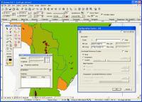
Canvas GIS Advanced (Mac) screenshots:
Canvas GIS Advanced (Mac) download tags:
GeoTIFF Shape files GIS GIS positioning engineering Graphics Vector illustration technical drawing Publication Desktop Publishing Presentation CAD
Copyright information:
Based on 3 ratings. 3 user reviews.